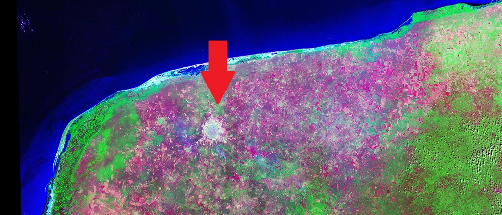
A shaded relief image generated by Shuttle Radar Topography Mission (SRTM) data shows the 300 kilometres-wide Chixulub Crater in Mexico. Image courtesy of NASA
A shaded relief image generated by Shuttle Radar Topography Mission (SRTM) data shows the 300 kilometres-wide Chixulub Crater in Mexico. Image courtesy of NASA